
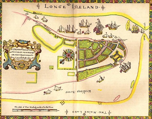
Glancing at the map, can anyone tell how much of Manhattan is there? Is that from 14th St down? 23rd St down? I'm just not sure. You can click it for a larger view.
Image via: Images of American History
UPDATE: The Bowery Boys posted this map on Monday, and added lots of information about Manhattan c. 1660ish.
More NYC: NYC The Tumblr | NYC The Twitter


No comments:
Post a Comment